
In Pompano we are starting the day off at 81° with a dew point of 75°. Today we will see morning clouds followed by a very good chance of showers and some thunderstorms, mainly between 2pm to 8pm. Some of these showers will be slow moving and could produce localized flooding. Tomorrow we are likely to see a few more showers but they will not be slow moving. Today’s high will be 91°.
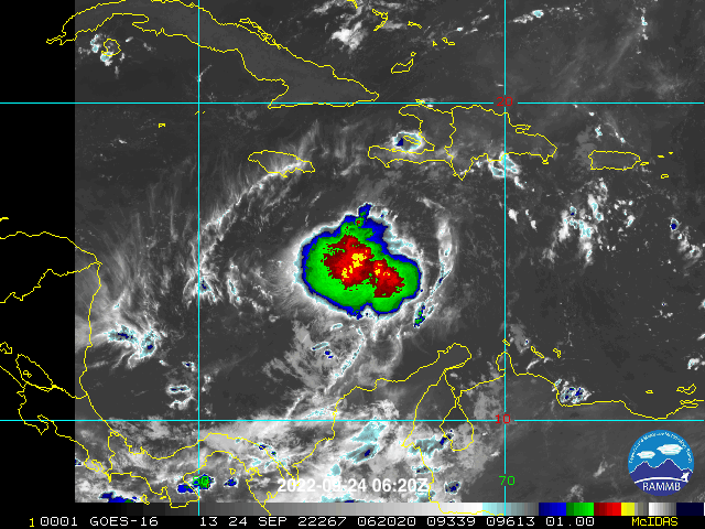
Last night TD9 was upgraded to Tropical Storm Ian. Most of Florida remains in the cone, the area that the center of the storm may travel over in the next five days. There has been some general consensus with the models with a slightly more westward track. Regardless, all of us should continue to monitor Ian for updates. Here is the latest advisory map and official forecast, model tracks, and rainfall totals for the next week.


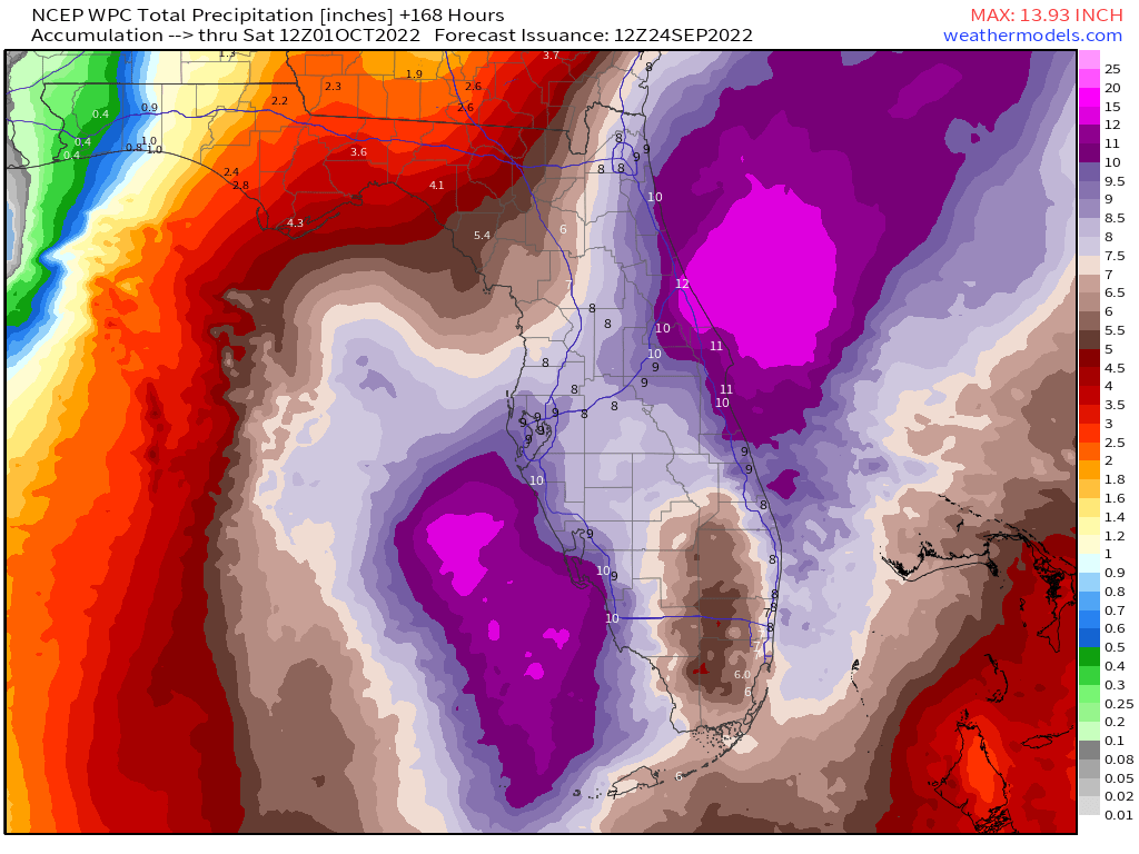
As of this writing, rainfall will be our primary threat from Ian on the SE Florida coast with rainfall totals between five and eight inches possible.
I will post updates through the day on Twitter @PompanoWeather
Discover more from Pompano Weather
Subscribe to get the latest posts sent to your email.
