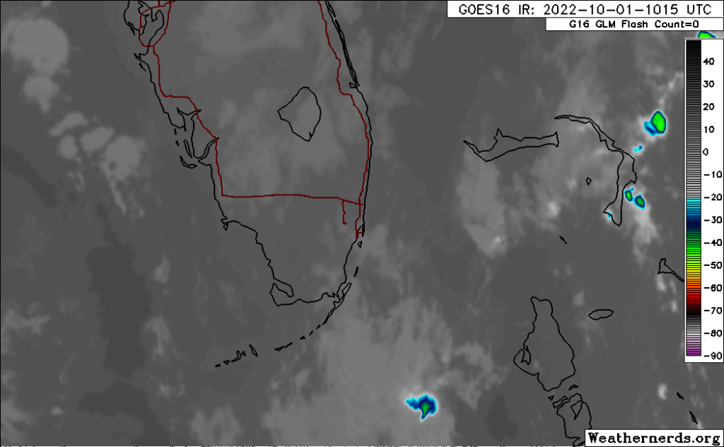
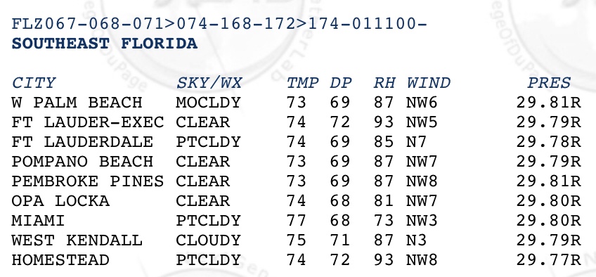
Almost a tranquil morning with just a couple of showers well offshore. In Pompano we have a temp of 73° and a dew point of 69°. Not quite as cool as yesterday morning but still refreshing. From satellite our weather is quite calmer than when we had Ian nearby.
Infrared satellite from 615am.Area observations from 6am.
Today we could see a shower mid to late afternoon otherwise we will see a day like yesterday with a bit more warmth, high 87°. We can expect nearly the same tomorrow.
In Pompano we are starting the day off at 81° with a dew point of 75°. Today we will see morning clouds followed by a very good chance of showers and some thunderstorms, mainly between 2pm to 8pm. Some of these showers will be slow moving and could produce localized flooding. Tomorrow we are likely to see a few more showers but they will not be slow moving. Today’s high will be 91°.
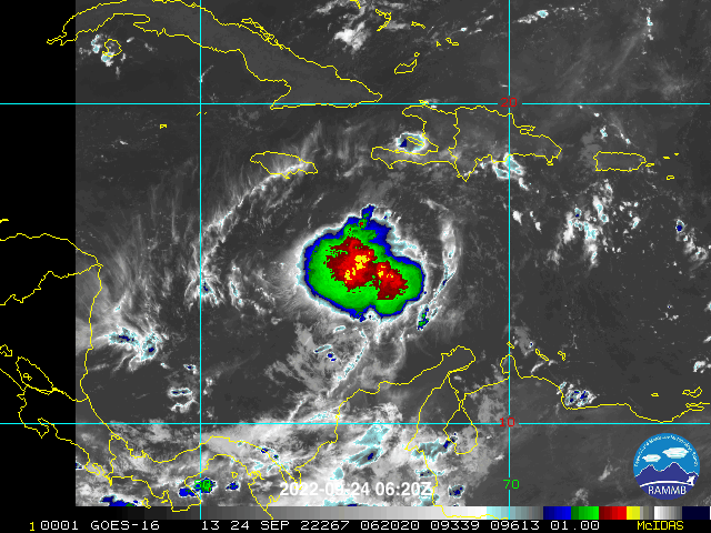
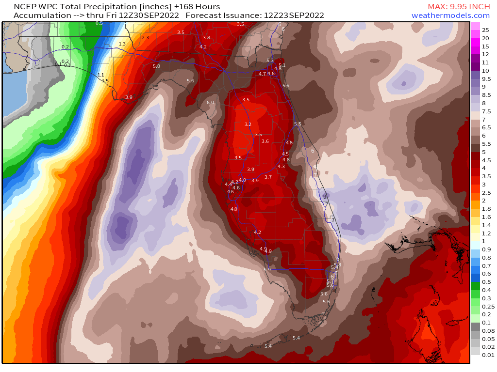
Last night TD9 was upgraded to Tropical Storm Ian. Most of Florida remains in the cone, the area that the center of the storm may travel over in the next five days. There has been some general consensus with the models with a slightly more westward track. Regardless, all of us should continue to monitor Ian for updates. Here is the latest advisory map and official forecast, model tracks, and rainfall totals for the next week.
As of this writing, rainfall will be our primary threat from Ian on the SE Florida coast with rainfall totals between five and eight inches possible.
I will post updates through the day on Twitter @PompanoWeather
Eyes are on Tropical Depression 9 that was upgraded this morning at 5 AM with most of Florida in the cone. A few items to keep in mind:
Too early to say that Florida will be affected
Too early to say what impacts this system will have
Use today and the weekend to get supplies you do not have and make plans IF the system were to go this way.
Finally, stay calm. The forecasts will become more refined as we go through the weekend. Always check in with the National Hurricane Center site for official information.
5 am advisory on TD9.
For today and the weekend: today will be mostly dry and typically warm with a high of 90°. Showers and thunderstorms return tomorrow and Sunday with highs of 90° and lows of 79°.
Beyond Sunday our weather will be dependent of the track and intensification of TD9. It is very likely that TD9 will become a Tropical Storm later today or tomorrow.
TD9 and it’s location to Florida.
Models are clustered showing agreement in the flyer track, but this may shift some due to the evolving storm structure and where the actul center forms.
2 am ET model runs.
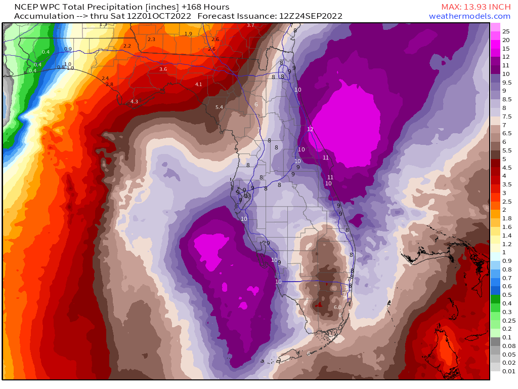
As of now, one thing we will likely see is rain. Regardless of where the center goes, most of Florida will get rain. The latest seven day rainfall forecast indicates plenty of rain for all of south and central Florida.
WPC seven day rainfall forecast.
I will have an update later this evening. Follow on Twitter for updates at @PompanoWeather
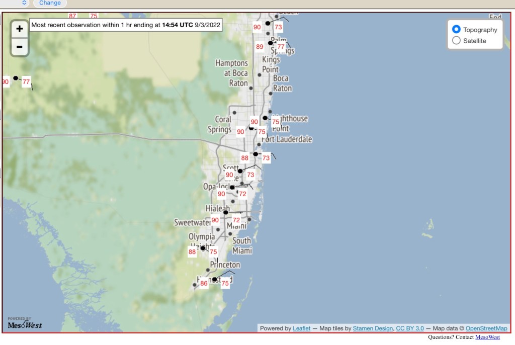
As usual this time of year we are already hovering around 90° with dew points between 73° and 75°.
11am temps and dew points.
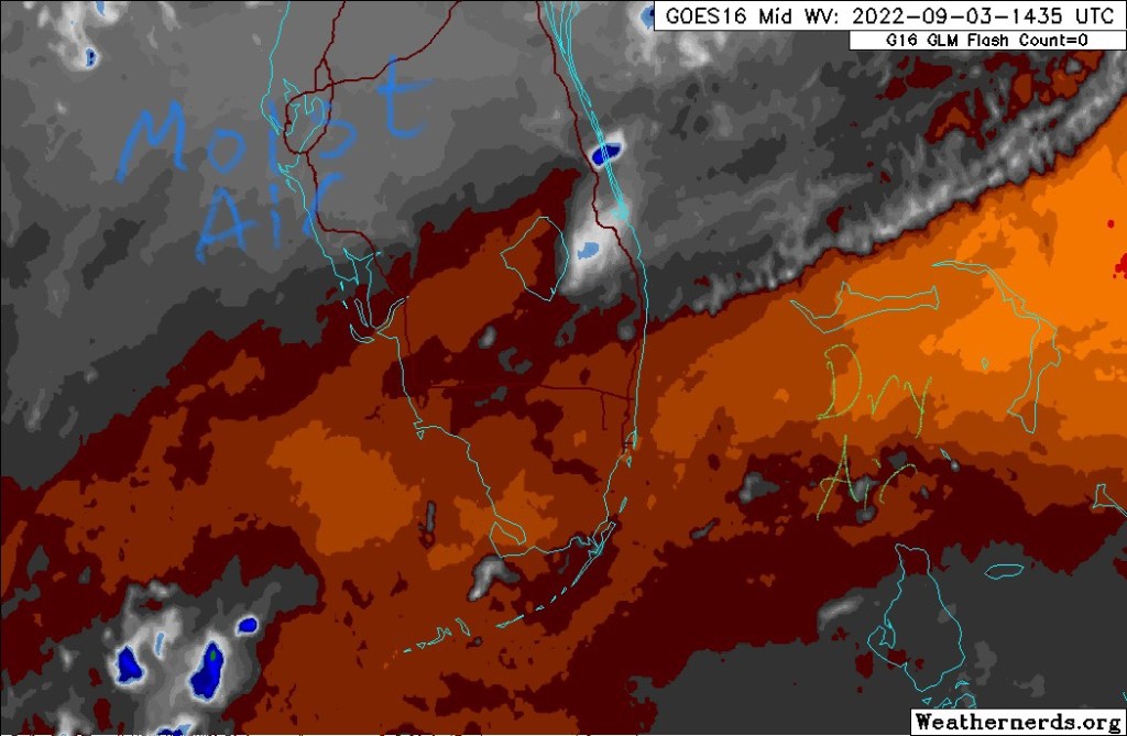
We have had some drier air work into the area overnight and this will help keep our rain chances down through the Labor Day weekend. Showers and a few thunderstorms are possible but not to the extent we have seen over the past week. The dry air can be see on water vapor imagery (in brown on this image).
Water vapor imagery from 1035 am EDT.
Highs today will be around 92° with our lows hovering around 80°.
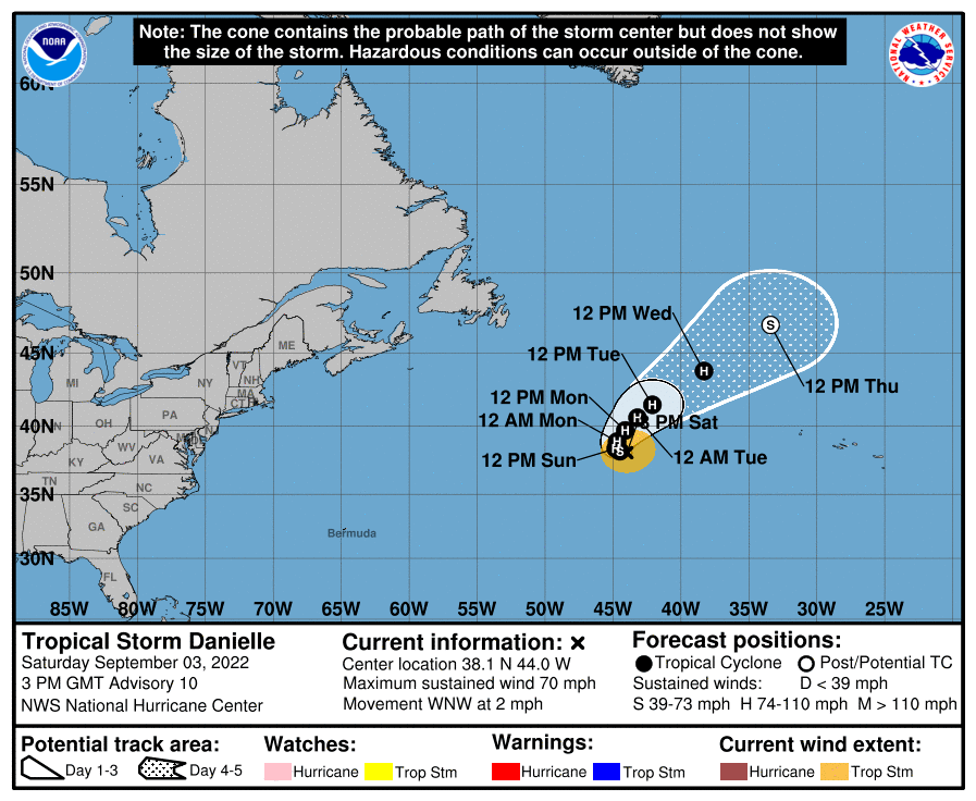
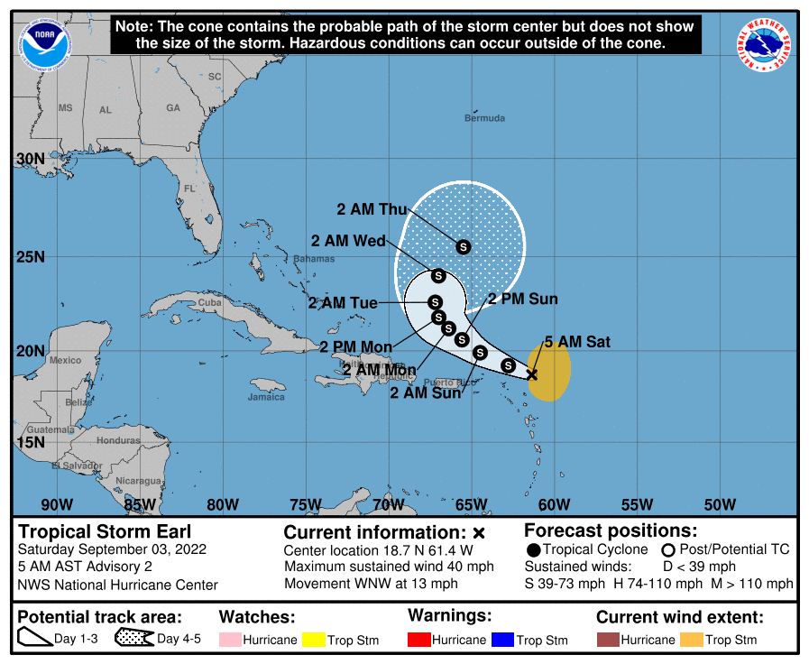
Tropics have picked up in activity with no threats at this time to the area. Hurricane Danielle is in the North Atlantic and newly formed Tropical Storm Earl north of the Leeward Islands. The 11am advisories and maps are below.
Follow on Twitter for updates @pompanoweather through the weekend.
Not a bad weather weekend ahead, though be prepared for some showers and possible thunderstorms as we go into Saturday and Sunday. Highs will continue to hover around 90° with lows around 80°.
Rainfall totals will be modest for those who do see rain, between a quarter and one-half inch through Sunday night.
Rainfall totals through Sunday night.
For those who may head out tonight to Pompano’s Old Town Untapped we should be mostly rain free, though a quick passing shower is possible. Temperature will be around 85° with partly cloudy skies and a light breeze.
Good morning, a few notes for the weather today and this weekend. Today we will see the start of a wet pattern across the area as a cold front to our north slowly creeps down the state and then stall over the weekend around the Lake area. We will warm and humid today with highs in the upper 80s and dew points in the 70s. A combination of these items will allow showers and some thunder storms to develop later today and then become more numerous over the weekend,
Forecast map for this afternoon.
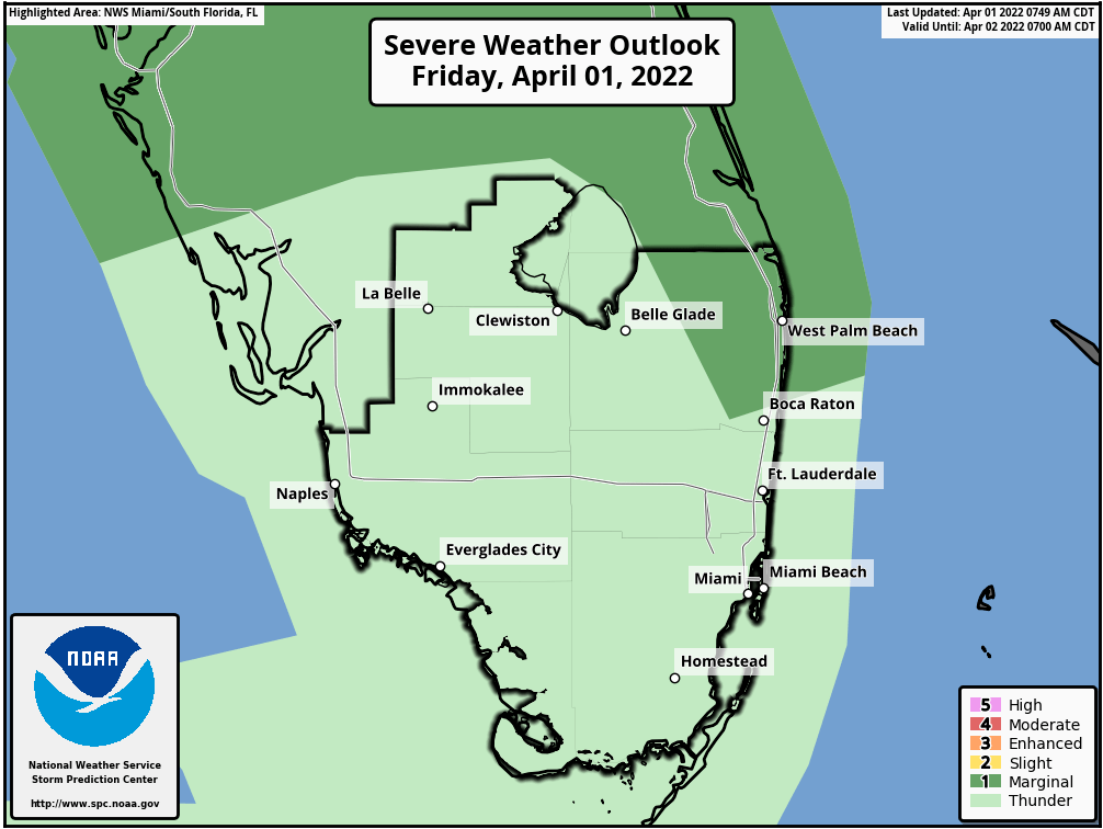
Saturday and Sunday we could see a severe weather threat across Broward and Palm Beach counties with the Storm Prediction Center placing us under a Marginal (level 1 of 5) risk of severe weather. For today the risk exists mainly to our north and to the west.
SPC severe weather threat map.
I will have an update later today to be more specific with the overall rain threat and severe weather possibilities.
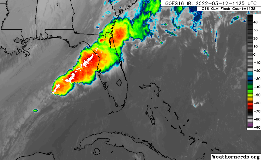
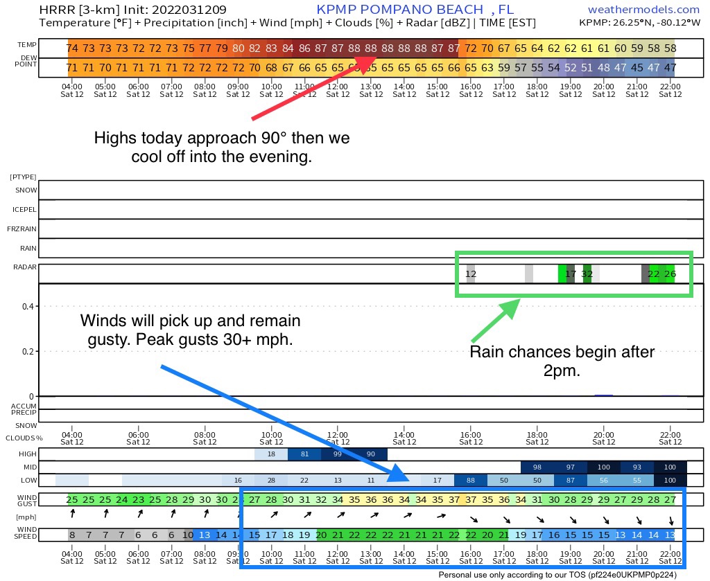
A lot going on today with the weather as a cold front will sweep through the area. Ahead and after the front winds will pick up and remain gusty. There is a Wind Advisory in effect from 10am this morning though this evening.
Wind Advisory for Saturday.Cold front can be seen over north Florida.
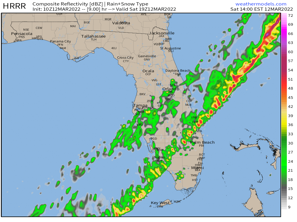
The first part of the day is going to be nice but very warm as the winds pick up. This will be followed by about 2pm with rain approaching then moving into the area. Rain will not be overall heavy and will linger into the evening. Then the colder weather will filter in.
Using the latest HRRR to outline the highlights of our weather today.Rain will be approaching SE Florida about 2pm using simulated radar from the HRRR.
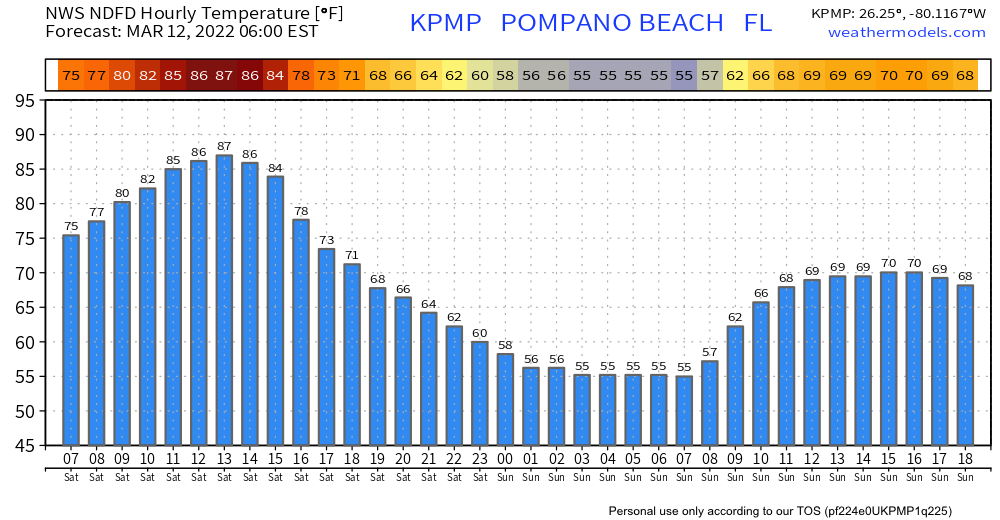
We can see the roller coaster of our temps for the next 36 hours.
NWS 36 hour temperature forecast.
Follow me on Twitter where I will post updates today at pompanoweather.
A variety of weather between now and the end of the weekend and we have time change on Sunday morning. Between now and the Saturday afternoon our temps will continue to climb a little each day with highs on Saturday around 90°.
NWS forecasted highs and lows.
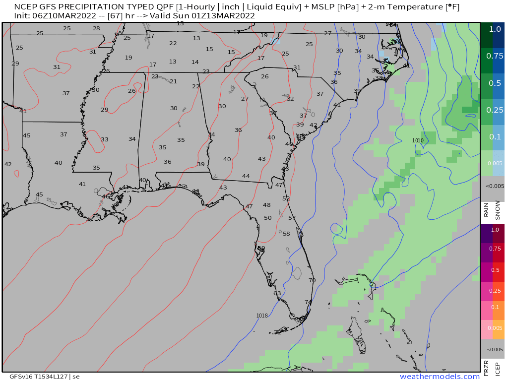
Then we have a cold front that will sweep through the area Saturday afternoon brining rain, possible thunderstorms, much cooler air and lower dew points for Sunday and the start of the new week. Rainfall amounts are not extend to be high, but if we do get a thunderstorm with the passage amounts could be higher than shown here.
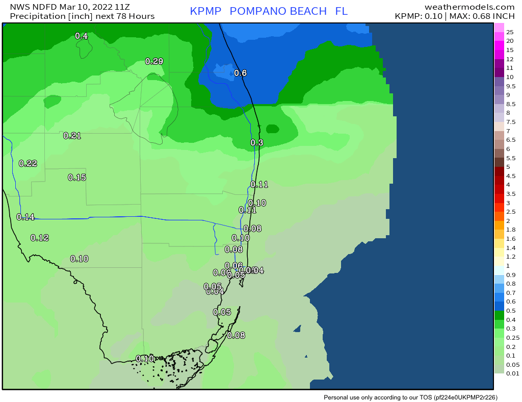
78 hour rainfall amounts, Thursday through Sunday morning.
By Saturday early evening the rain will stop, winds will pick up a bit and the cool air will filter in that will give us a wonderful Sunday weather wise. This is a comparison of the GFS and Euro for the timing of the frontal passage.
Euro had the passage by early about 6pm with the GFS a couple hours later.
We have a beautiful weather weekend ahead with warm temps and breezy conditions. The only downside will be dangerous rip currents at the beaches.
High pressure will be in control of our weather which will lead to mostly dry and mostly sunny weather. We have a very slight chance of an isolated, light shower through Sunday.
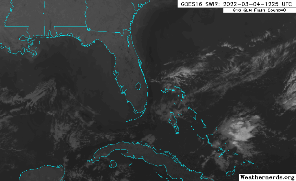
Friday morning satellite image showing very little in the way of activity near Florida.Surface map for Saturday morning.
Our temperatures will not be extreme for this time of the year, highs around 80° and lows around 70°. Though we will warm up next week.
NWS seven day forecast.
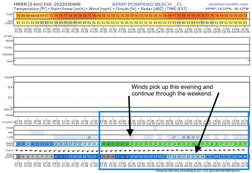
The most noticeable weather this weekend will be the wind. Wind will increase gradually today and then pick up more tonight and park on Sunday when we may have gusts up to 25mph. The HRRR model shows this clearly as we see gust up to 20mph tarting around sunset tonight.
Early Friday HRRR 48 hour output.
Plan to get out this weekend and enjoy this time of year in Florida. Plenty of activities going on including the Renaissance Festival in Deerfield. Just stay out of the water at the beaches.