Happy Thanksgiving 2025

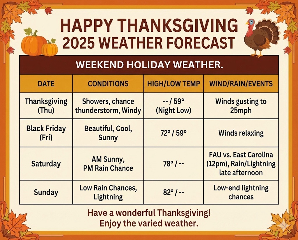
Not a bad holiday weekend, but we will have a variety of weather. A weak cold front will move through the area today, keeping a low chance of showers and even a thunderstorm later today. Later on Thanksgiving we’ll see the winds pick up, with some gusts as high as 25 mph.

Overnight, temps will drop a bit, with a Black Friday low of 59°. A beautiful, cool day follows on Friday, with winds relaxing a bit and a high of 72°.

Saturday morning will not be as cool, with rain chances remaining near zero until the afternoon. It looks like a great day for the last FAU football game of the season, kicking off at 12:00 PM on Saturday against East Carolina, with a high of 78°.

By late Saturday afternoon, low rain chances return as the front moves north, and low-end lightning chances will be present through Sunday, with a high of 82°.

Have a wonderful Thanksgiving!

11/9/2025 – Strong Cold Front Tuesday

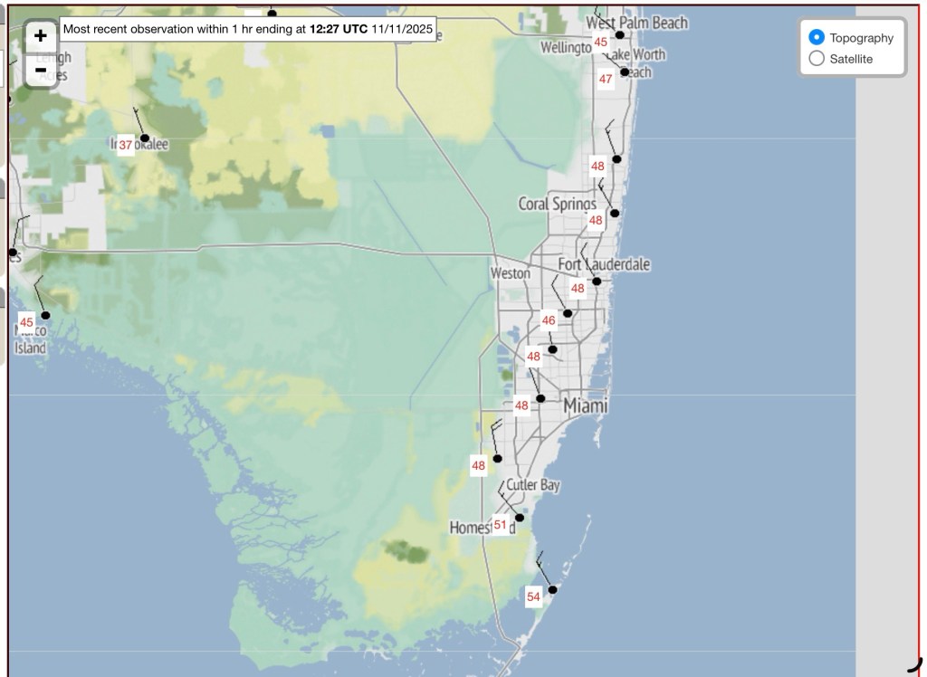
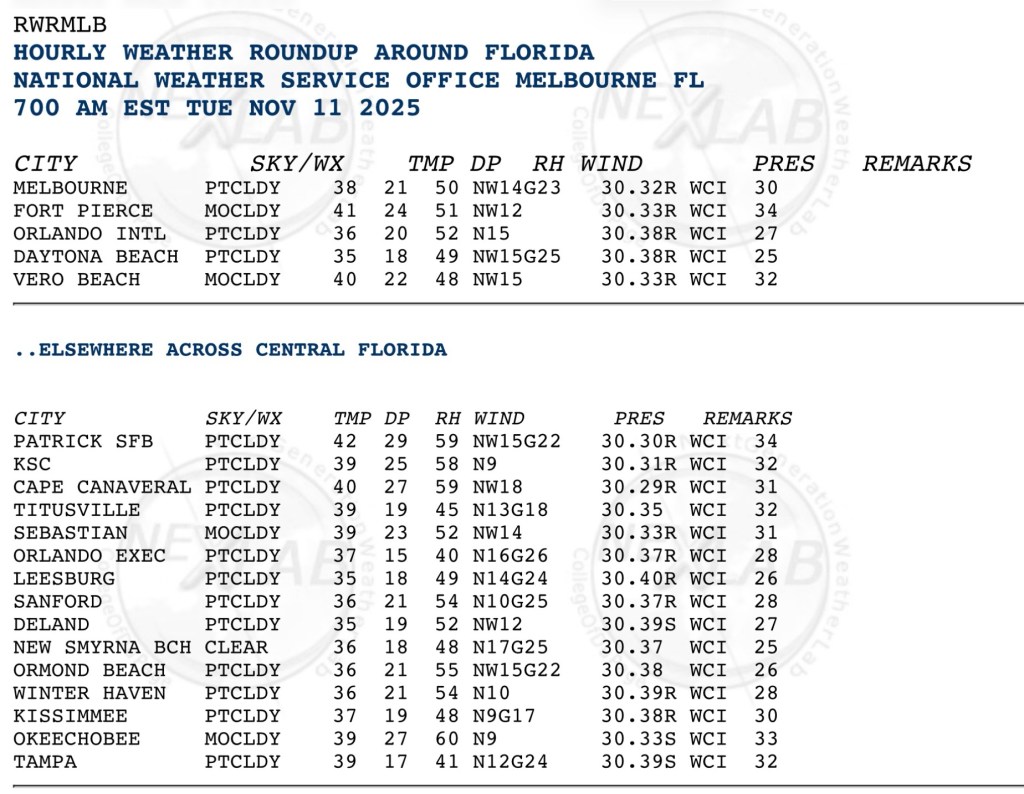
Our first significant cold front of the season will sweep through on Monday, which will bring in colder temps for Tuesday morning, and many of us will see our first sub-50F morning since March.

As we go later in the week, we will quickly warm up as our lows remin in the 60s through Friday and highs will be around 80. Rain chances will return as we get into the latter part of the week.

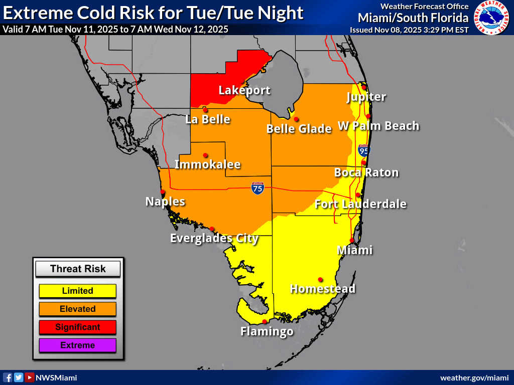
Here is the risk of Extreme Cold for Tuesday and Tuesday night.

Further Reading

Sharing this article from Ars Technica on the recent performance of Google’s DeepMind tropical model and how well it has performed this season:

https://arstechnica.com/science/2025/11/googles-new-weather-model-impressed-during-its-first-hurricane-season/

11/7/22 Subtropical Storm Nicole Forms

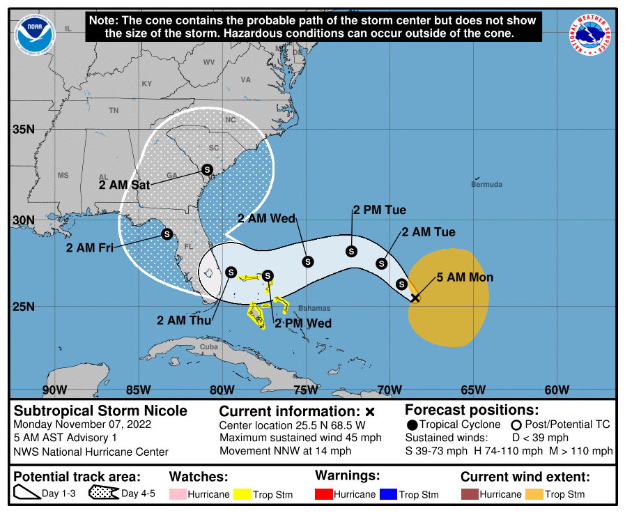
Subtropical Storm Nicole has formed from the system I posted about last night. Max winds are 45 mph. Tropical Storm Watches have been issued for parts of the Bahamas. I would expect watches or warnings to be issued for parts of south Florida later today or tomorrow morning.

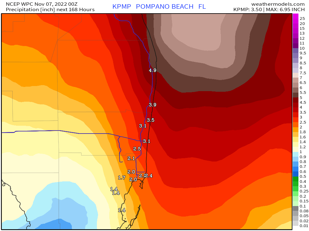
Impacts have not changed, strong gusty winds and rainfall up to five inches will affect the area starting late Tuesday through Thursday.

I will post updates through the day on Twitter and another post here this evening.

First advisory on Subtropical Storm Nicole.

11/6/22 Tropics Are Not Quiet – Wind and Rain Mid to Late Week for South Florida

Generally in November we do not see much activity, but this November has been different with just first the six days. We have had two hurricanes in the Atlantic, Lisa and Martin, and now we are expecting development of the system designated 98L.

With that said, we can expect rain and wind mid to late week. Expected conditions include sustained winds up to 30 mph and gusts to 45 mph (tropical storm force) along with rainfall totals of up to four inches.

This forecast will be refined as we go into the week, please stay tuned and check back. On to the graphics.

Area number one is the one we are watching for Florida impacts mid to late week.
Latest models from 7pm tonight. The models are in good agreement on the path, but we need to see if this track is maintained as the system develops.
Latest rainfall forecast through Sunday.

I will have an update Monday morning and may update via Twitter later this evening if needed.

10/1/22 – Weekend Outlook, Nice with a Slight Chance of a Showers

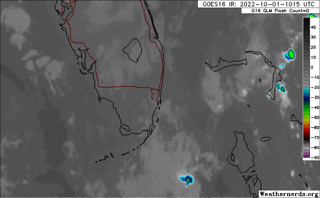
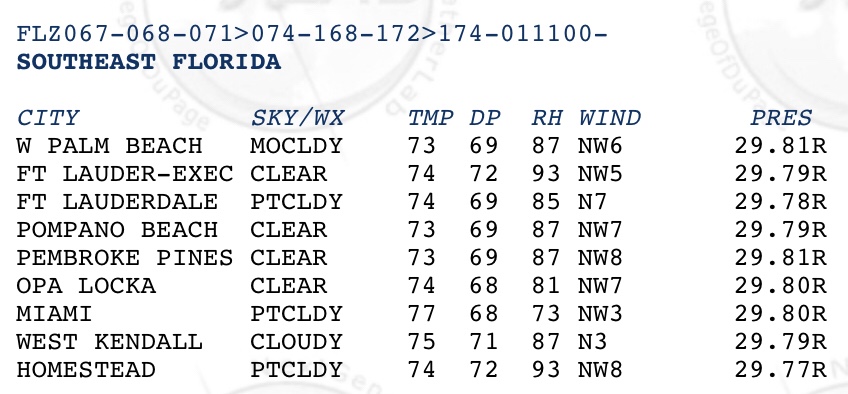
Almost a tranquil morning with just a couple of showers well offshore. In Pompano we have a temp of 73° and a dew point of 69°. Not quite as cool as yesterday morning but still refreshing. From satellite our weather is quite calmer than when we had Ian nearby.

Infrared satellite from 615am.
Area observations from 6am.

Today we could see a shower mid to late afternoon otherwise we will see a day like yesterday with a bit more warmth, high 87°. We can expect nearly the same tomorrow.

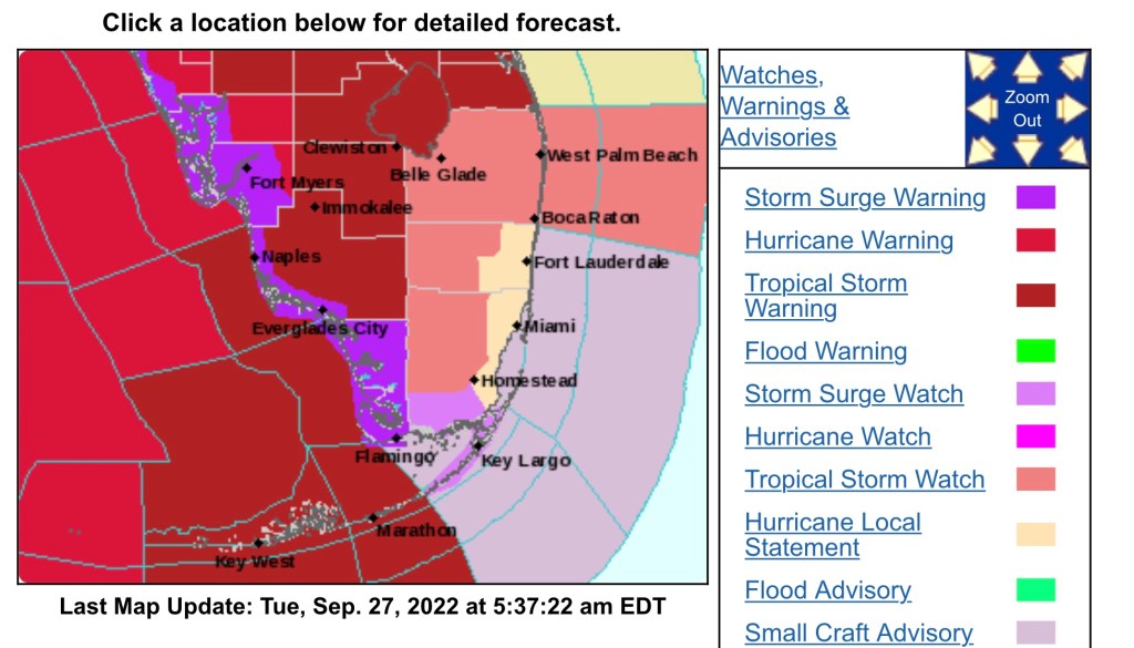
9/27/22 – Tropical Storm Watch Issued for Parts of a Broward and All of Palm Beach

Due to the possibility of sustained Tropical Storm winds (39 to 73 mph) are now possible for parts of Broward and all of Palm Beach counties. In summary, Boca Raton north and roughly the western half of Broward.

Watch/Warning map for south Florida

Additional changes in the watches and warnings are possible as we go through the day.

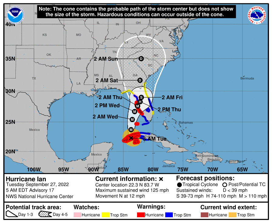
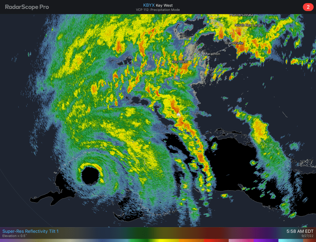
Below is the latest advisory graphic and the latest radar image from Key West where we can now see the eye over western Cuba

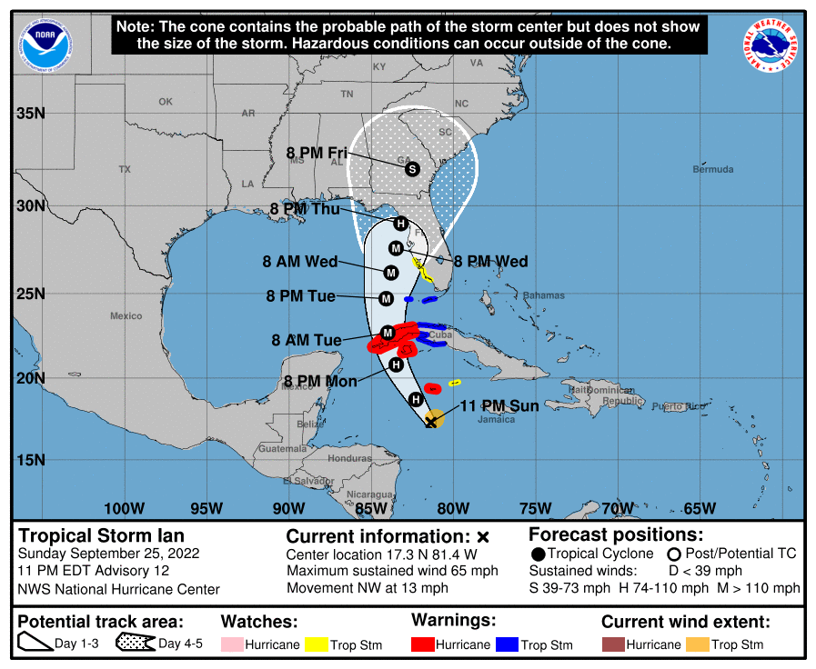
9/25/22 – 11pm Work Week Forecast, Ian Impacts

Focusing on the impacts we can expect this week with Ian’s path approach to Florida’s west coast. Here is the summary of what to expect Tuesday through Thursday.

  • Rainfall: 3-8 inches, locally higher in some areas
  • Winds: 15-25 mph sustained, gust to 40 mph in stronger storms
  • Tornadoes: short-lived tornadoes possible Tuesday/Wednesday

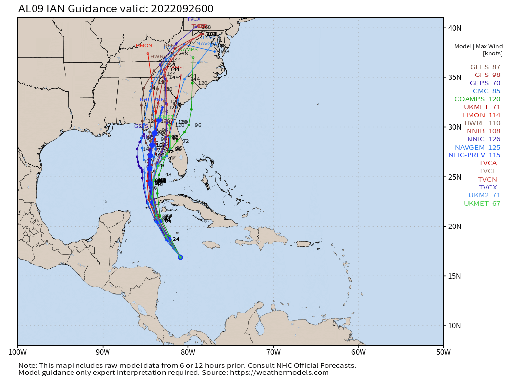
Latest models from tonight show little change and are tightly clustered for the first 48 hours

9/25/22 8pm models

Latest advisory graphic:

9/25/22 – 2 PM Ian Update and What to Expect This Week

As of 2pm Ian remains a 50 mph tropical storm that is expected to strengthen rapidly.

2 pm advisory for Tropical Storm Ian.
2 pm model runs.

For this week, if there are no significant changes in the course of Ian, we will see plenty of rain. Current forecast is for seven inches in northern Broward with higher amounts possible.

Rainfall forecast through late Friday night.

With the rain there will be squall lines that will produce heavier rain for a period of time. Localized flooding will be likely. The other threat will be the possibility of tornadoes. The Storm Prediction Center has the area under a Marginal risk for Tuesday.

These aspects will continue to be fine tuned as Ian approaches.