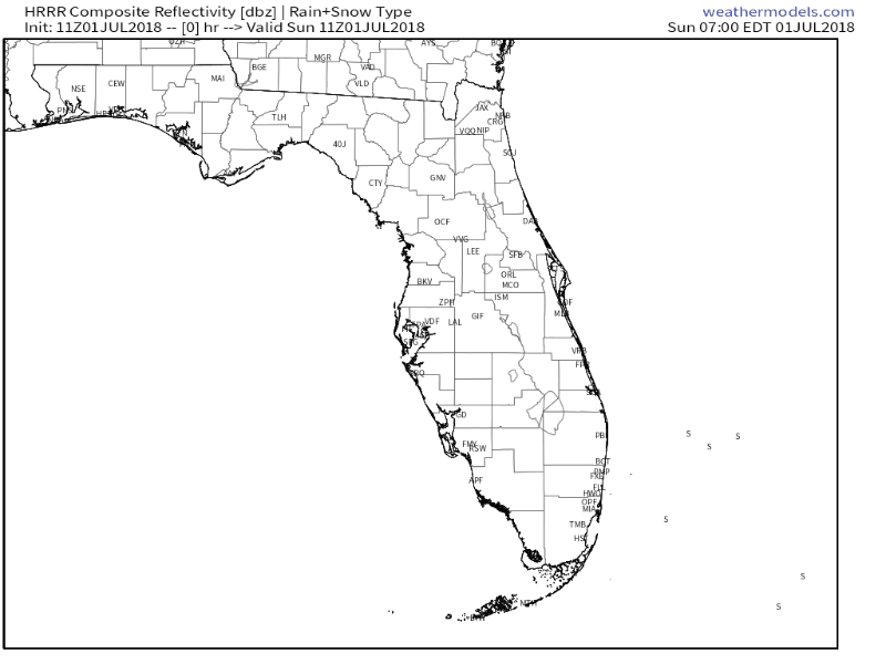
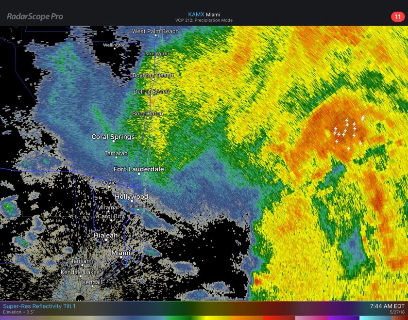
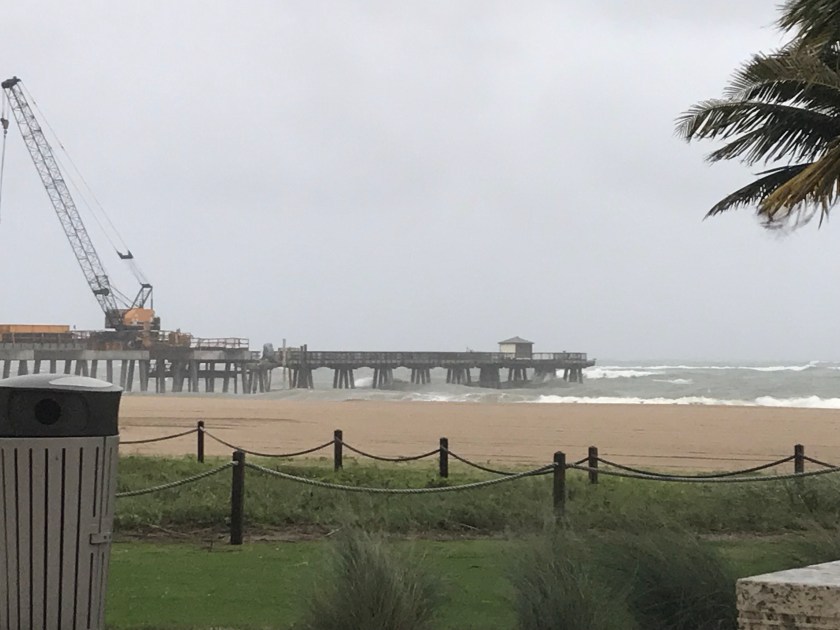
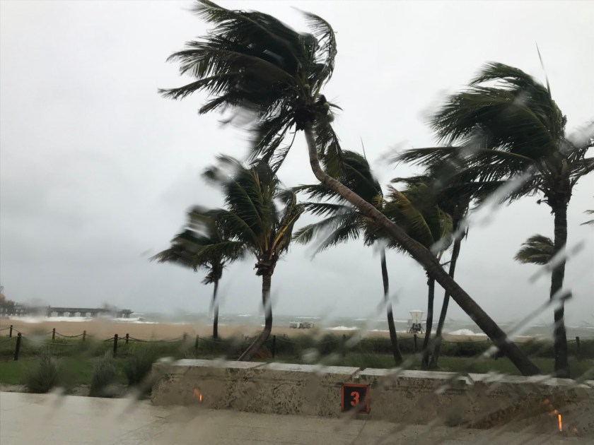
At 8am we are at 80F in Pompano with showers and thunderstorms affecting our coastal areas. Light accumulations of rain over night with .08 inches at my house. 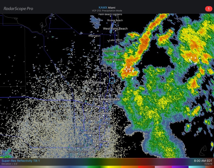
Like yesterday, expect some periods of sun but also more shower activity today and tomorrow. The activity is expected to move slower than yesterday so in addition to lightning be cautious of local flooding in areas of heavier, prolonged rain.
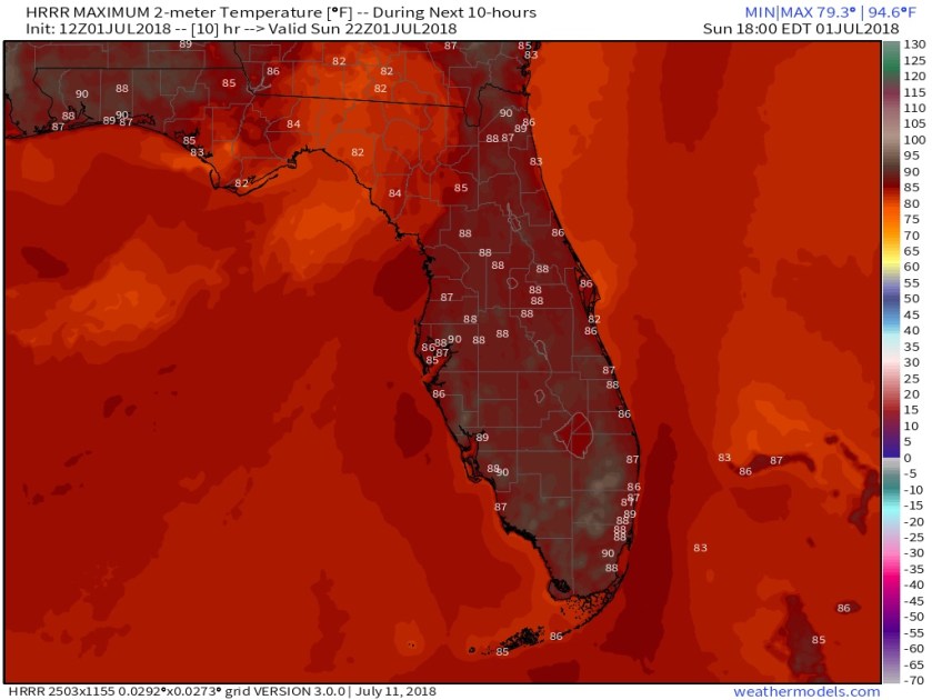
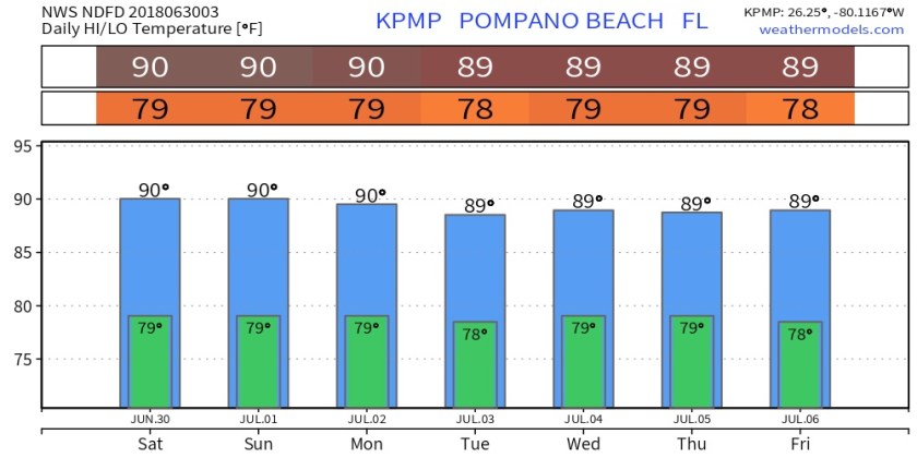
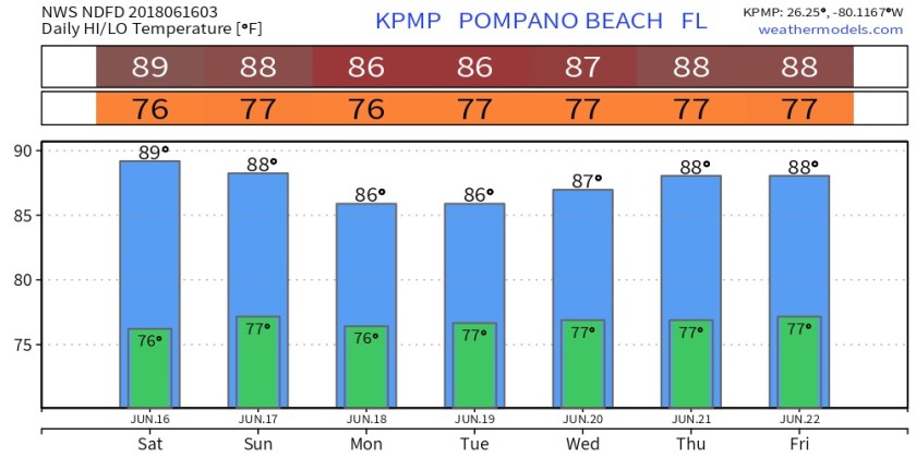
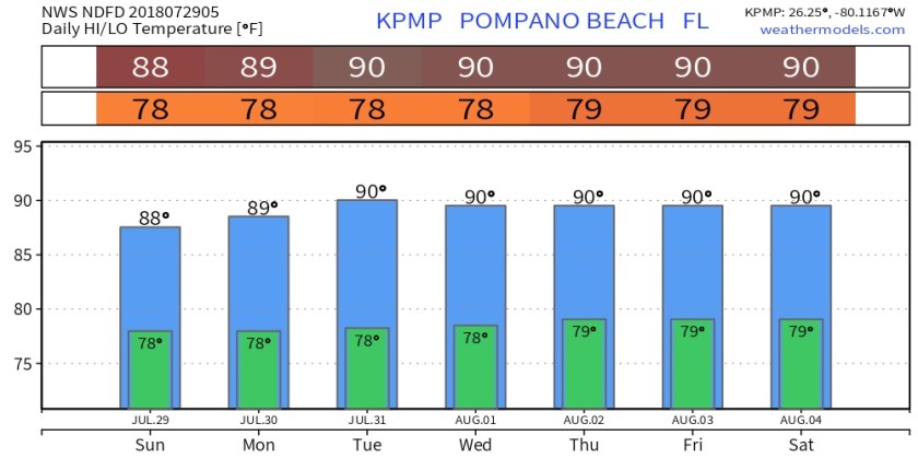
This pattern will be with us for the start of the work week with some decrease in shower activity starting Wednesday. Highs today will be 90F with low a low of 79F tonight. This range will be expected through most of the week.
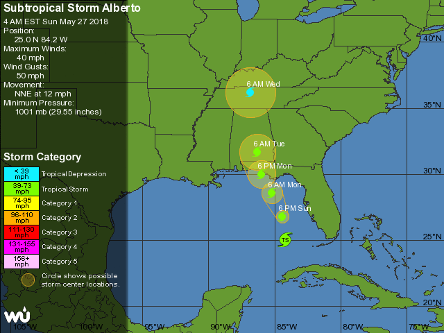
Tropics remain quiet at this time with no significant areas the National Hurricane Center is currently watching.
Enjoy your day!
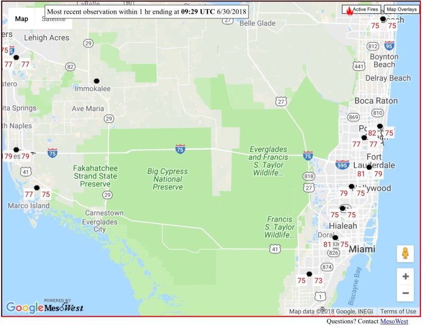
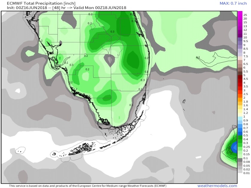
 As we go into the coming work week we will return to about normal rain chances and about normal temps. Latest NWS temps for Pompano like this.
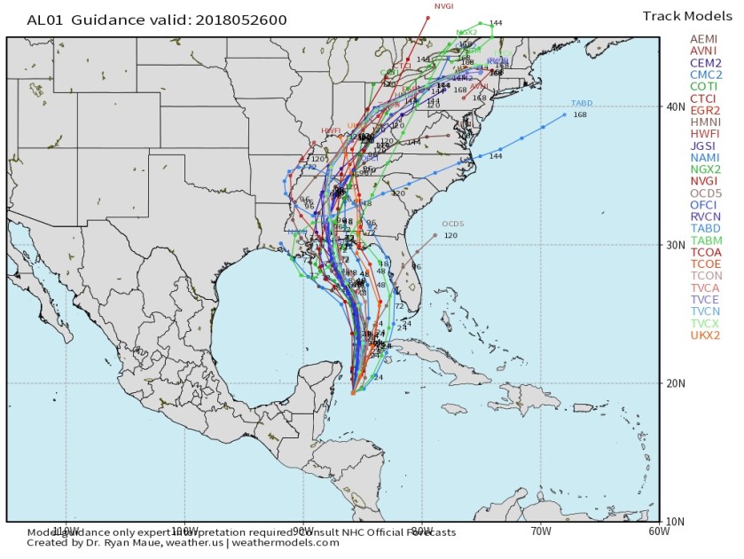
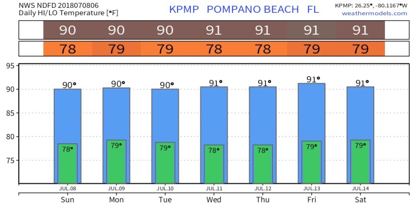 Tropics have become a bit busier since we entered July. What was hurricane Beryl in now Tropical Storm Beryl moving west-northwest this morning with max winds of 45mph. Air Force recon has found Beryl disorganized and there is little signs of strengthening over the next few days. Latest model plots look like this.
 Tropical Storm Chris was upgraded this morning from TD3. Chris should be of no concern for us. Chris is forecasted to strengthen as it meanders off the Carolina coast the next couple days.
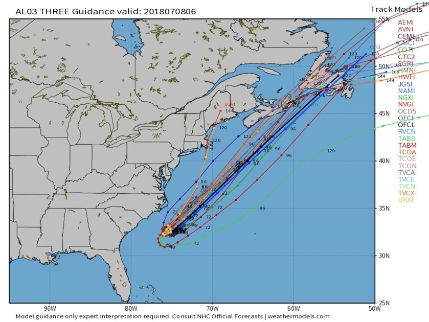 Enjoy your Sunday!