
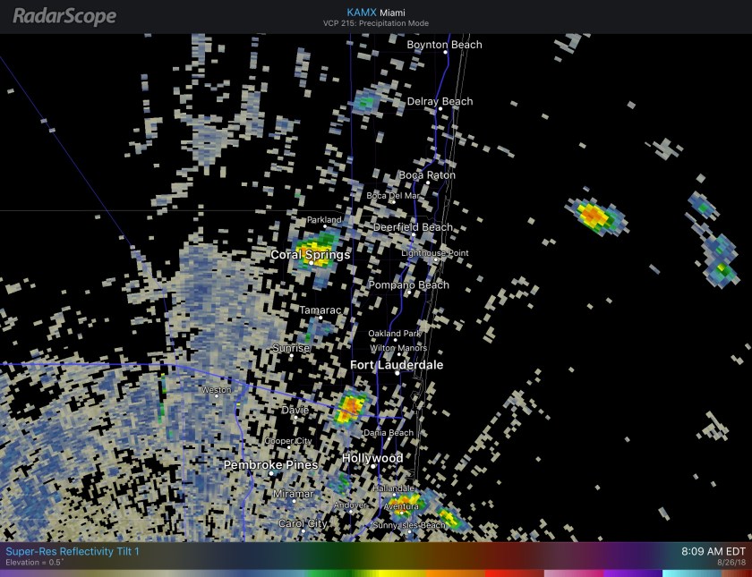
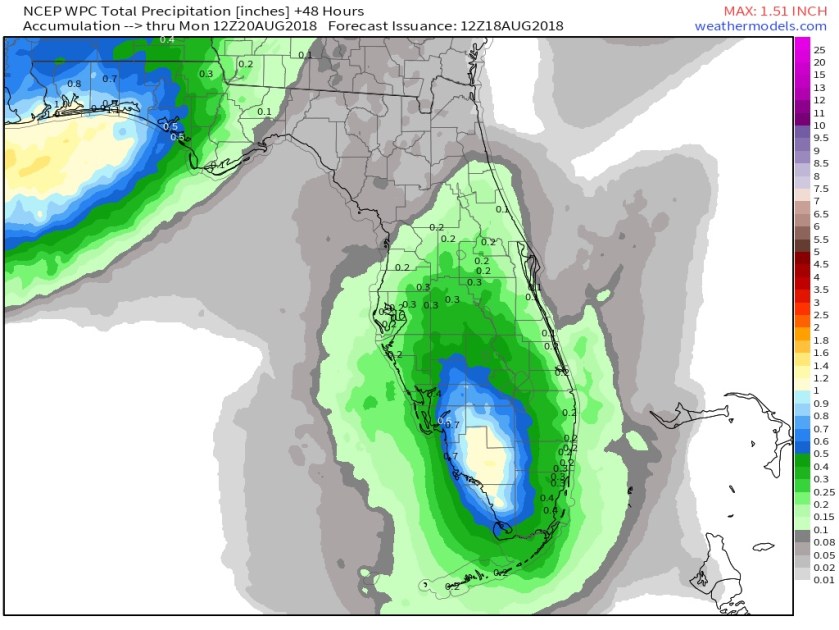
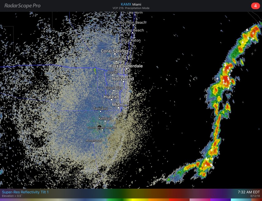
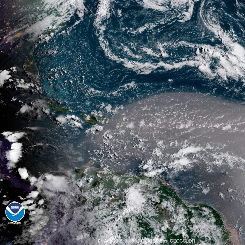
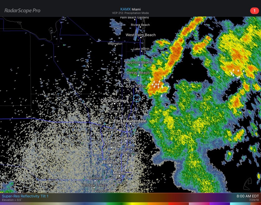
With some clouds around we are starting this Saturday off at 76F with near calm winds. We have an upper level low over us which will aid in bringing some showers and thunderstorms to the area today. Latest predictive radar shows not all will get rain but some heavier activity will be around.
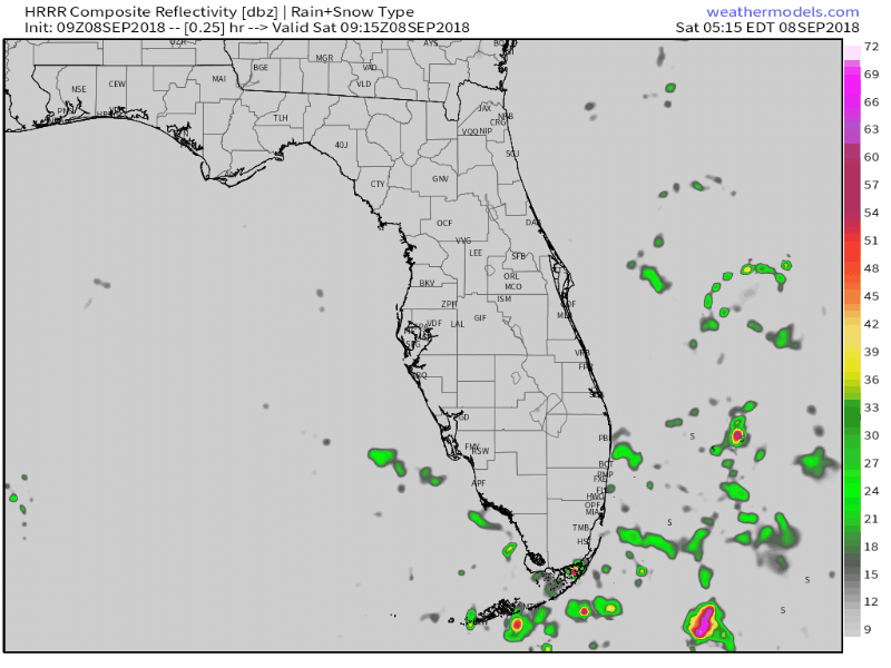
Highs today will be 89F with the times of sunshine we will see along with our showers.

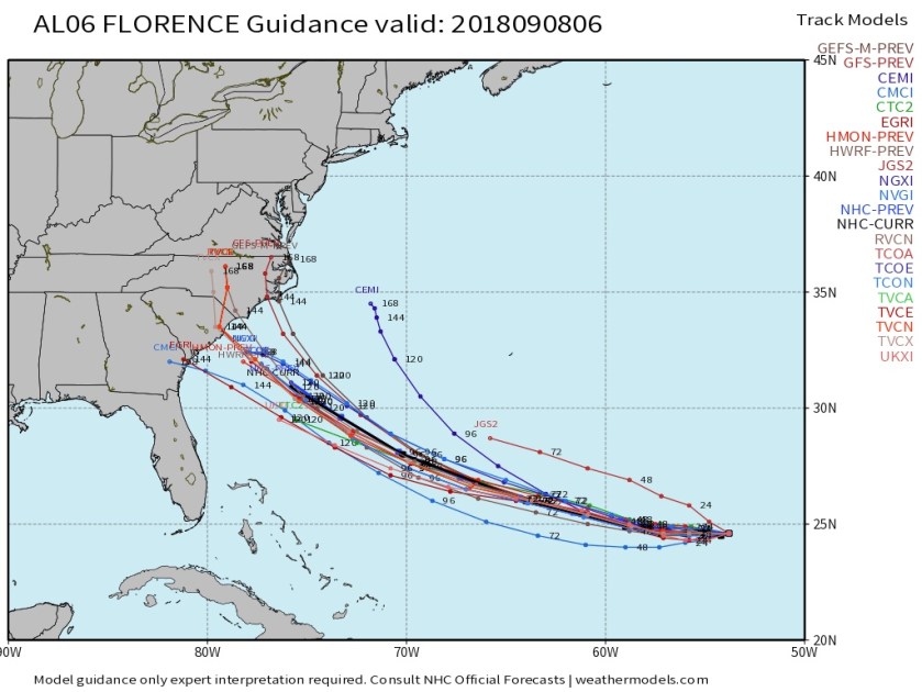
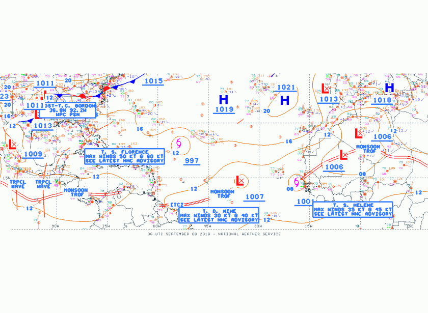
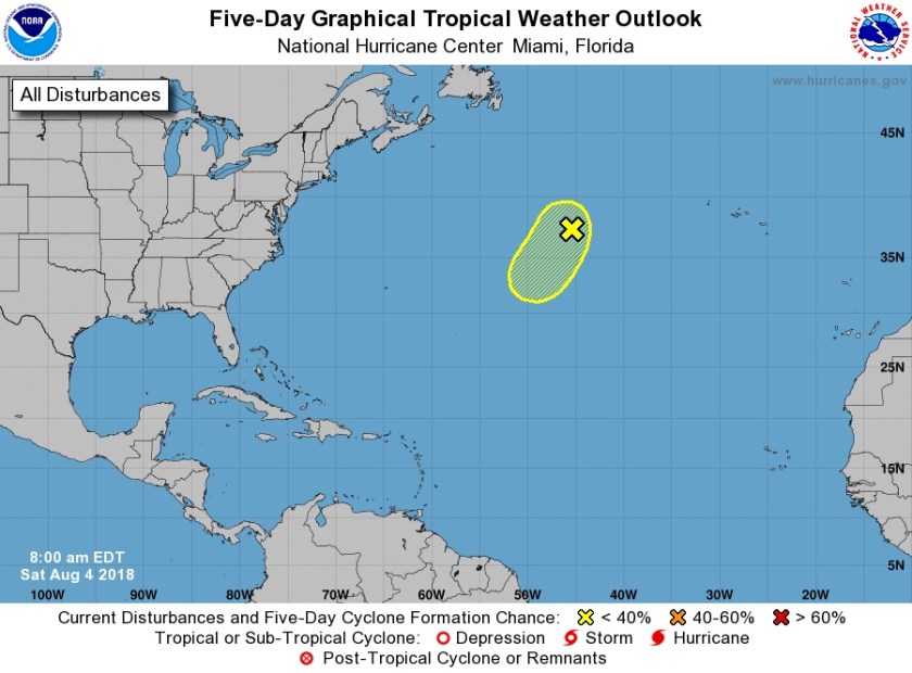
Tropical Storm Florence is one of the systems we are watching. Though most outlets are advertising a mid-Atlantic coast event it is still a bit early to completely rule us out. We need to continue to watch Florence for any changes. Though latest models runs are encouraging to south Florida.
Along with Florence there is also Tropical Storm Helen and Tropical Depression 9. The later two are too far out to make any call on at this time, but we will continue to watch.
Further updates on Florence will be posted to Twitter over the weekend and I will have an update tomorrow morning at the latest.
Enjoy your day!


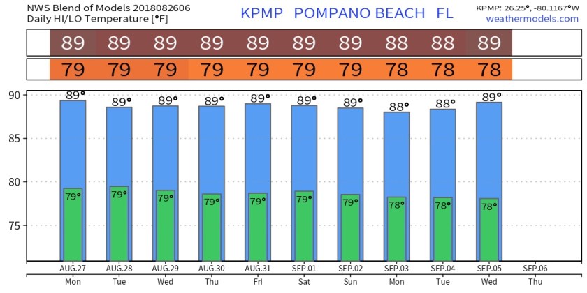

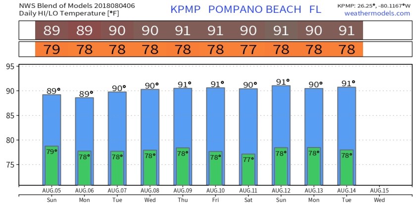
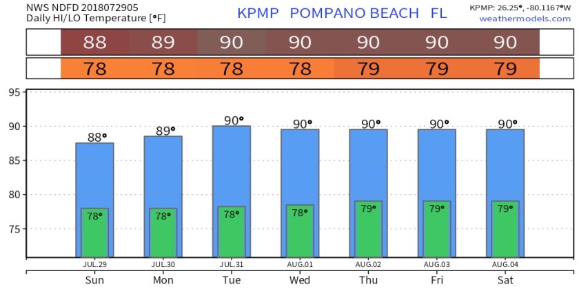
 As we go into the coming work week we will return to about normal rain chances and about normal temps. Latest NWS temps for Pompano like this.
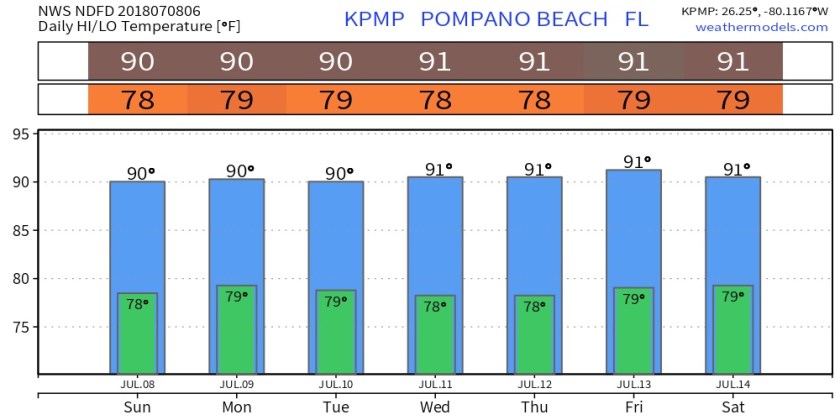 Tropics have become a bit busier since we entered July. What was hurricane Beryl in now Tropical Storm Beryl moving west-northwest this morning with max winds of 45mph. Air Force recon has found Beryl disorganized and there is little signs of strengthening over the next few days. Latest model plots look like this.
 Tropical Storm Chris was upgraded this morning from TD3. Chris should be of no concern for us. Chris is forecasted to strengthen as it meanders off the Carolina coast the next couple days.
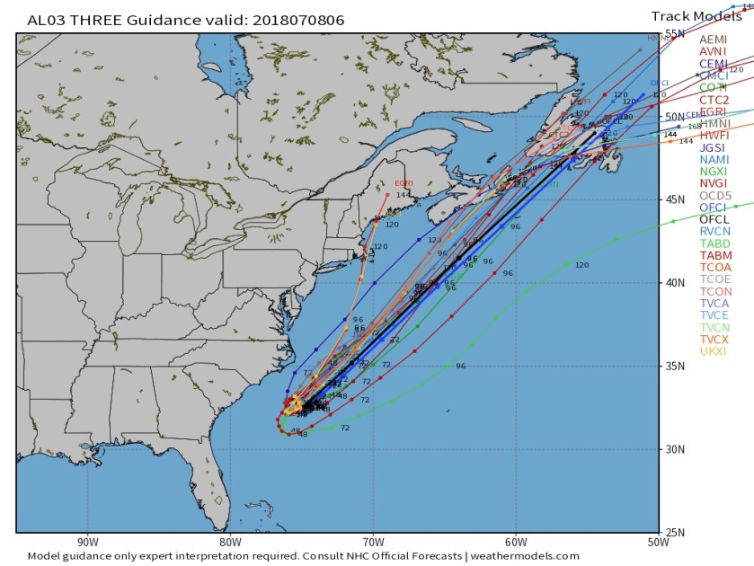 Enjoy your Sunday!