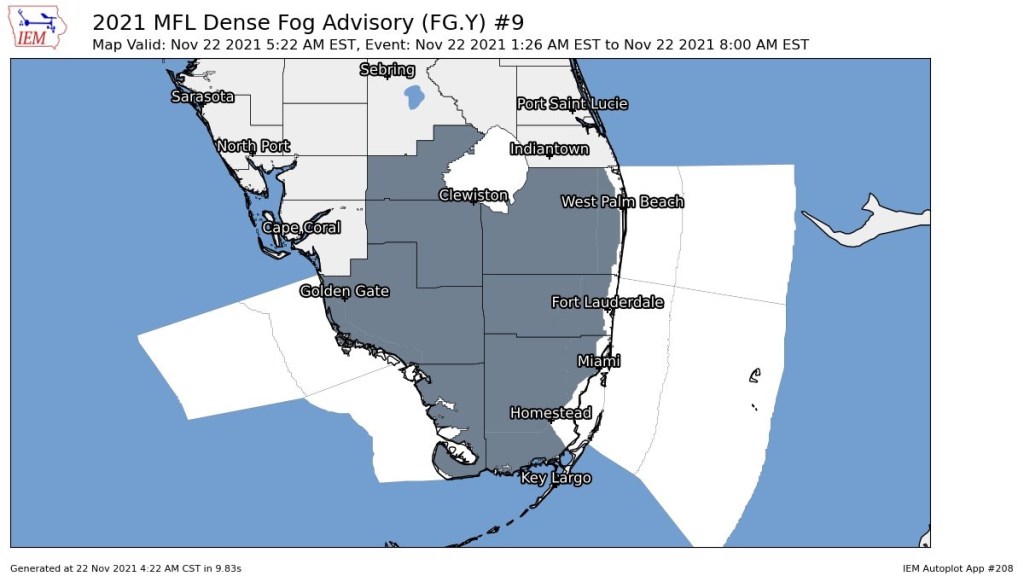
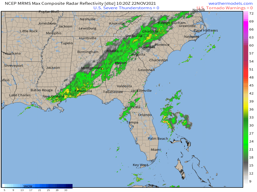
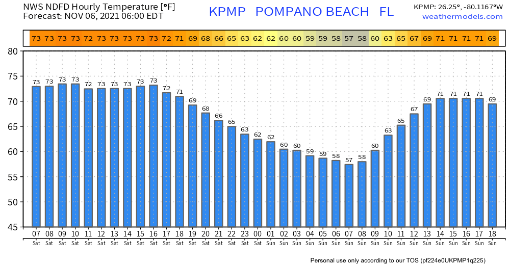
The cooler weather has arrived giving us breezy and drier conditions. Sunny conditions will be around today with winds between 15 and 20 mph with gusts as high as 25 mph. With the onshore flow we could see some very light showers. These will be quick and almost non-accumulating.
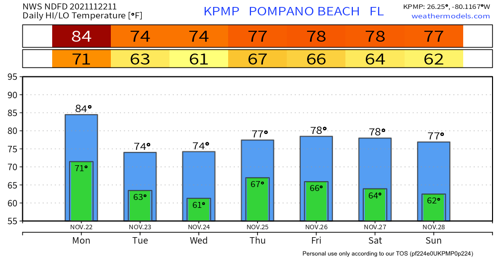
Breeziness will stick with us through tomorrow with some increase in cloudiness, but we will remain mostly sunny. Temps through the week will not change much.

Next cold front is on Friday, still not expecting much rain or weather with it which will reinforce our pleasant weather for the weekend.